Our favorite Roman ruin in the South of France is the Pont du Gard, the aqueduct bridge located in the Gard Department of Languedoc-Roussillon about 60 km (37 miles) from our home in Sablet, between Remoulins and Uzès.
The Pont du Gard is part of the 50 km (31 mile) Nîmes aqueduct constructed by the Romans in the 1st century between 41 and 54 AD to bring water from a spring near Uzès, the Fontaine d'Eure, to the Roman city of Nîmes where it was distributed to fountains, baths and private homes around the city.
On our most recent visit with daughter Tricia and family, we parked in the lot on the Rive Gauche - Left Bank, there is a small charge for parking but access to the bridge is free, and strolled along the path until the Pont du Gard came into view.
 |
| View of Pont du Gard as you arrive from Visitor's Center |
The 900 foot long Pont du Gard has three levels of arches: six crossing the Gardon River, 11 in the middle tier and 35 smaller arches at the top which support the water channel. The Pont du Gard is 161 feet high above the Gardon river.
 |
| Stonework on the Pont du Gard, showing the protruding blocks that were used to support the scaffolding |
You can walk across the bottom tier which has been used as a thoroughfare for centuries - in 1285 the bishop of Uzès ordered that a toll be collected from all travelers crossing the bridge.
 |
| Shirley and grandchildren Caedon and Avery |
The Pont du Gard was built of limestone from nearby Estel quarry that borders the Gardon river's left bank and assembled largely without mortar or clamps. The stones, some of which weigh up to 6 tons, were cut to perfectly fit together eliminating the need for mortar. The cut stone was lifted into place with a human-powered treadmill providing the power for the winch.
 |
| View of Pont du Gard from upper trail |
Shirley and I always look at the arches and admire the skill it took to design the Pont du Gard without computers and imagine the thankless labor of soldiers, craftsmen and slaves who built the bridge almost 2000 years ago without cranes or other equipment.
 |
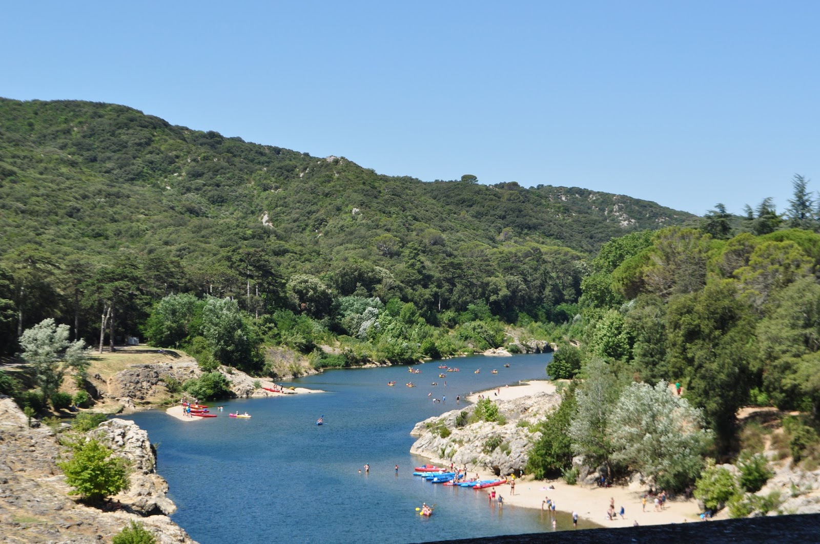
| Swimmers along the Gardon River near the Pont du Gard |
The Aqueduct of Nîmes had a capacity to carry 35,000 cubic meters of water a day that took nearly 27 hours to flow from the spring to Nîmes. The aqueduct descends in height by only 17 m (56 feet) over its entire 50 km (31 mile) length, an indication of the precision the Roman engineers were able to achieve using rudimentary technology.
 |
| View south down the Gardon River from the upper trail near Pont du Gard |
Bringing water from the spring near Uzès to Nîmes was easier said than done. Although the distance between the spring and the city is only 20 km (12 miles) in a straight line, the Romans built the aqueduct 50 km (31 miles) mostly underground in a long, winding route to cross or circle the natural obstacles of the countryside.
 |
| Side view of the Pont du Gard showing the three levels of arches |
The Pont du Gard carried water in the channel seen below across the gorge of the Gardon River.
 |
| Channel on top of Pont du Gard that carried water across the Gardon River |
The Pont du Gard is remarkably well preserved and was added to UNESCO's list of World Heritage Sites in 1985.
 |
| View of the Pont du Gard from the Right Bank of the Gardon River |
The Pont du Gard can be accessed from either the right bank or left bank of the Gardon River. There are several places where you can swim in the river if you so choose.
 |
| Another view south of the Gardon River from the Pont du Gard |
I remember visits to the Pont du Gard when I was very young, probably in connection with visits to my grandmother's family who lived near Anduze in the Gard Department, and swimming in the Gardon River near the Pont du Gard.
 |
| View south down Gardon River from Pont du Gard |
 |
| View north up the Gardon River from Pont du Gard |
Make sure to look at the ancient olive tree on the Rive Gauche - Left Bank on the path to the Pont du Gard from the Visitor Center. The sign by the tree says it was born in 908 and lived in Spain till 1985 when the Counsel General of the Gard adopted the tree and planted it here in 1988.
 |
| Ancient olive tree along path to Pont du Gard from Left Bank Visitor's Center |
A good way to explore the Pont du Gard is as part of a visit to nearby Duchy of Uzès which is worthwhile. There is a wonderful Marché Provencal in Uzès on Saturday mornings, one of our favorite markets after the Tuesday morning market in Vaison la Romaine.
With our grandchildren visiting, we didn't go to Uzes but rather after grabbing snacks at the Visitor's Center, we headed to Collias France to get canoes to go up the Gardon River under the Pont du Gard. Check back to see my next post where I share pictures of our visit to Pont du Gard by canoe.
How funny--we went there yesterday. I have wanted to see it for years. It was bigger and better than I had imagined.
ReplyDeleteI Think that the Pont du Gard is one of the most amazing structures I have ever seen. The fact that they could build such a perfect structure without the benefit of any technology or mechanical aids, is unbelievable to me.
Delete